fbpx

Detour to Vinland

If you got across the bar, you still needed to beach your boat. L'Anse aux Meadows.

If you got across the bar, you still needed to beach your boat. L’Anse aux Meadows.
The last two days have helped me understand the Homeric sea (Winslow, notthat other guy). At times, the sea boils with startling ferocity against the shoreline. Winslow Homer’s art was in making us believe that the sea is always like this, and in seeing that ferocity as romantic.
When I was a child, what was referred to as Vinland in Old Norse sagas (and by medieval historians) was only imperfectly understood. Controversy still raged over whether the Norse had ever reached past Greenland into North America. Today, we assume that Vinland included Newfoundland and the Gulf of Saint Lawrence as far as New Brunswick. That’s logical but not conclusive. The only confirmed Norse site in Canada is at L’Anse aux Meadows, at the very northernmost tip of Newfoundland.
Imagine beaching a boat through those boulders. L'Anse aux Meadows.

Imagine beaching a boat through those boulders. L’Anse aux Meadows.
Prior to the Norse settlement, there were various other prehistoric people in this part of Newfoundland. However, none of them stayed. The Dorset people were driven out by global warming during the Medieval Warm Period; the Mi’kmaq left because it was too cold. Archaeologists believe the Norsemen eventually left because of the weather as well: extreme cold drove their food sources south.
The sky had cleared but the wind still blew fiercely when we reached L’Anse aux Meadows. The visitor’s center, now closed for the season, was unfortunately set square in the middle of the path. I climbed around the building on its uphill side and hopped the fence to the boardwalk. Mary was aghast and followed me reluctantly.
Reconstructed longhouse at L'Anse aux Meadows.

Reconstructed longhouse at L’Anse aux Meadows.
“I’m not the first person to do this,” I said, pointing out the faint path along the slope.
“If all your friends jumped off a cliff, would you do it too?” she retorted.
I raised that kid all wrong.
The longhouses faced the cove in a gentle curve pointing at the shoreline. I don’t understand how that boulder-strewn coast was navigable by any boat. The reconstructed sod longhouse is remarkably contemporary in feel. It could be a settlement in the Dakotas; it could be a modern earth ship.
A poignant reminder that none of our work here lasts forever.

A poignant reminder that none of our work here lasts forever.
I knew we could make better time returning on a different path. Still, I have a healthy respect for quicksand and sinkholes. Former President George H.W. Bush sank into it up to his armpits in Newfoundland. So when Mary suggested an alternative route with a boardwalk, we decided to be prudent.
That is how we managed to walk in a wide sweep for 5 km trying to get back to our car. It was bracing, but it gave us quiet time to reflect on the Norsemen who were drawn here. What in this bleak and cold landscape, with its buffeting winds and lack of topsoil, seemed attractive to them?
Cow Head boats.

Cow Head boats.
We set off south with time for one small painting. We were far enough north that we could see Labrador, and its peaks were dusted with snow, as were the strange worn mountains at Gros Morne National Park. I set up to paint there, but my easel was blown over before I even got started.
Small waterfalls cascaded down to the road after the storm cleared.

Small waterfalls cascaded down to the road after the storm cleared.
In the end, that was fine. We made it to the ferry terminal as cars were lining up to board. Today is calm and lovely, and I’m heading to the Cape Breton Highlands.
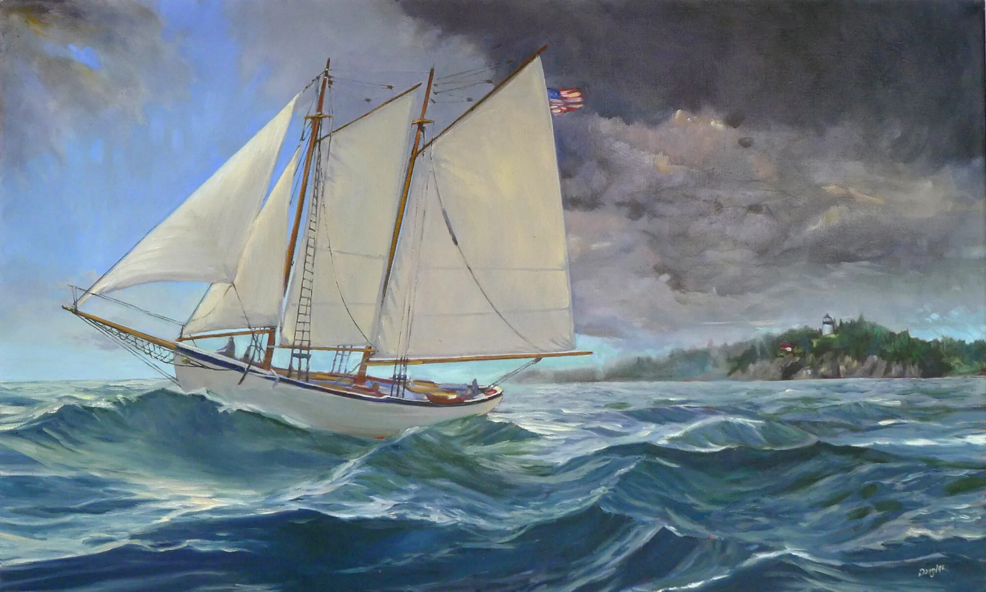
The Night Ferry

"Cape Spear Road," oil on canvas, by Carol L. Douglas.

“Cape Spear Road,” oil on canvas, by Carol L. Douglas.
My Canadian-born neighbor used to tell Newfie jokes. Until Friday, that was all I’d ever heard about Canada’s easternmost province. I’ve wandered around the other Maritime Provinces, but you have to make an effort to get to Newfoundland. It is an eight-hour ferry trip from Cape Breton Island.
Our timing was dictated by the availability of ferry space on this holiday weekend. There are only two trips a day, and today is Canadian Thanksgiving. We decided to drive through from New Brunswick to Nova Scotia to catch the night ferry. We would return on Monday night and pick up our last two provinces on the way home to Maine.
That gave us three days to traverse Newfoundland in both directions. The most sensible thing was to drive straight to St. John’s and work our way back west from there. That means our last three provinces will be done in reverse.
Fog flowing down the mountains near Port-aux-Basques, Newfoundland.
Newfoundland looks very much like the Scottish Highlands and Hebrides. That’s not surprising, since they’re two sides of the same sea. Wind-stunted trees and shrubs cling to granite ridges that drop suddenly to the water. On the other hand, it’s also profoundly familiar, being an extension of the Acadian coastline that runs from Maine through New Brunswick and Nova Scotia.
It’s moose season here. I haven’t seen this many men in camouflage since we left British Columbia. The ferry was full of them. As we waited to disembark, a moose call reverberated across the hold. Around us, men laughed and cheered.
My supply of some paints is almost depleted.

My supply of some paints is almost depleted.
On Sunday morning, Mary dropped me off near Cape Spear to paint while she ran an errand. Cape Spear is the easternmost point in North America excepting Danish-owned Greenland. It is also the site of the venerable (1836) Cape Spear light. World War II bunkers and gun barrels face the ocean.
I was startled to hear a moose bugle, since I wasn’t more than a few miles out of St. John’s. About thirty feet down the road, an animal track threaded back into the woods. When I finished painting, I decided to follow it. There was a remarkable quantity of old bear scat, but at least it didn’t appear to include the remains of plein air painters.
I reached a boggy spot and turned around. The track ended at the shoulder of the road; where did the wee beasties go after they crossed? I noted a disturbance in the gravel and dropped down off the shoulder, only to stop short at a pile of moose entrails and sawed-off legs. They were recent enough to not yet stink.
Encountering a moose or bear is one thing; encountering a hunter when I wasn’t wearing safety orange was another thing altogether. I scurried back to the road, just in time to meet Mary.
At St. John's harbor.

At St. John’s harbor.
St. John’s is the capital of Newfoundland and Labrador. Its commercial harbor is filled with trawlers, freighters, and other working boats. Its streets are every bit as pretty as San Francisco’s, but without all those annoying poseurs who plague California. I swear I saw Queen Elizabeth’s body double leaving church in an emerald green coat and matching hat.
Street after street of colorful row houses in St. John's, Newfoundland.

Colorful row houses in St. John’s, Newfoundland.
We headed east and north. At Hare Bay, a great rock promontory rises behind a modest village. This is everything I love to paint, and I set to it with a will, trying to capture as much as I could before we lost our light.
A local woman—born in this village and now sunk well into middle age without having ever left—stopped to chat. This is actually unusual in Canada, where people seem more reticent to interrupt strangers. In the waning light, I saw a mink swim toward shore. She and Mary tried to find it, but it was too fleet for them.
Hare Bay (unfinished), by Carol L. Douglas.

Hare Bay (unfinished), by Carol L. Douglas.
There seemed to be more cars than usual. “Everyone here goes to church on Sunday evening,” she told us. As we left town we noticed that each church was indeed lighted and full of people. Living here, they have much to be thankful for.

Île d’Orléans autumn day

“Île d'Orléans waterfront farm,” by Carol L. Douglas.

“Île d’Orléans waterfront farm,” by Carol L. Douglas.
Gabriel-from-Quebec tipped us off that ĂŽle d’OrlĂ©ans, just a few minutes downriver from Quebec City, would be a great place to paint. Electronic media puts you in contact with people you would never have met otherwise. They’re frequently excellent sources of information.
The ĂŽle was settled in the 17th century and evidence of its feudal system is still visible. Small holdings stretch in narrow strips down to the water. This put tenants close to their neighbors and maximized access to the water.
Quebec City is also a city of waterfalls. Montmorency Falls is 272' tall, making it nearly a hundred feet taller than Niagara Falls. And it has the requisite suspension bridge, too.

Quebec City is also a city of waterfalls. Montmorency Falls is 272′ tall, making it nearly a hundred feet taller than Niagara Falls. And it has the requisite suspension bridge, too.
It’s hard to imagine that a feudal system was ever successful in the New World, let alone that it persisted for centuries, but that happened in French Canada. Seigneuries were not granted to nobles as in France, nor did the land grants confer nobility. They were generally given to military officers and churchmen for services rendered. Later, these seigneuries were purchased by canny English and Scottish investors who recognized a profit when they saw it.
The tenants cleared the land, built their own homes and barns, farmed, and paid rent to the seigneur. They were suckers to the Crown, since in New France, land was plentiful and labor was dear. Still, the system was not formally abolished until 1854, long after the demise of New France. The last rents were not settled until—seriously—1970.
Île d’Orléans is too varied to ever be captured in one painting. In some places it is Quebec agriculture, with strawberry fields and apple orchards marching neatly down to the St. Lawrence River. In others, it looks surprisingly like the Maine coast, with seasonal cottages set among woodland. Houses of mellow golden stone dot the landscape.
While I painted, Mary quizzed me on French animal names. Vaches and poulet I already knew; dauphin confused me. Wasn’t that the title for the heir apparent to the French crown? Souris amused me, because I’d just painted in a Manitoba town of that name last week, and it was, indeed, just a little bit mousy. It was a beautiful, warm, autumn day. Abeilles buzzed among the the clover.
"Bas-Saint-Laurent sunset," by Carol L. Douglas.

“Bas-Saint-Laurent sunset,” by Carol L. Douglas.
I hated to leave Quebec without another painting, even if our detour to ĂŽle d’OrlĂ©ans had been time-consuming. At La Pocatière, I stopped to paint the sun setting over the St. Lawrence estuary. Even this far upriver, the St. Lawrence is vast enough that there are beluga whale nurseries. At the moment, there were also two men parasail-waterskiing in the stiff wind.
The paper mills at Edmunston, New Brunswick and Madawaska, Maine call to me even in the dark.

The paper mills at Edmunston, New Brunswick and Madawaska, Maine call to me even in the dark.
The Bas-Saint-Laurent is a beautiful area and so is the St. John River Valley, where we stopped for the night. This is home country. In fact, a right turn and we could be home for lunch. In many ways, that knowledge is the hardest thing we’ve encountered so far.

Ces vaches-la sont mes vaches

"Marshes along the Ottawa River, Plaisance," by Carol L. Douglas.

“Marshes along the Ottawa River, Plaisance,” by Carol L. Douglas.
I set off on this journey with only three pre-conceived painting ideas: Kluane Lakeand the Liard River in Yukon, and Nepean Point in Ottawa. None of them have worked out exactly as planned.
I’ve avoided painting cityscapes, as this was meant to be an exploration of the Great White North itself, not its people. But the Ottawa River curving below theVictorian High Gothic Parliament is a skillful intertwining of natural and created beauty.
Growing up near the twin, starkly contrasting cities of Niagara Falls, NY and Ontario, I’ve often pondered why our Canadian neighbors are so much better at designing public spaces than we Americans. Washington, DC, is an unpleasant city. Our White House huddles behind high fences ostentatiously patrolled with lethal weaponry, and the Mall is usually a cluttered mess. Parliament Hill in Ottawa is gracious, accessible, and beautiful. And still, it’s somehow safe, as the 2014 shooting incident pointed out.
The one that got away: Parliament Hill in Ottawa.

The one that got away: Parliament Hill in Ottawa.
Alas, my painting was not to be. The Alexandra Bridge is closed for repairs, meaning the roads at the National Gallery end are rerouted. After endless circling, we gave up and headed east through Quebec. It was already early afternoon.
At Ottawa, we left the bilingual belt and entered French-speaking Canada. I can decipher small bits of French on paper because of its similarity to English, but I have a tin ear for the nuances of pronunciation. French, in particular, terrifies me. It is an unintelligible sea of strange sounds.
We raised a flock of seagulls along a side road.

We raised a flock of seagulls along a side road.
I was determined to paint along the Ottawa River somewhere, having missed my opportunity in the city. East of Ottawa, the river becomes a migratory bird sanctuary, low and marshy.
Signs for Le parc national de Plaisance took us deep into farm country. We stopped and asked directions of a very handsome young public safety officer. He didn’t speak English. At that moment, a determination to learn French blossomed in Mary’s heart.
Quebec roadside rest stop.

Quebec roadside rest stop.
While I painted, she practiced with Duolingo. The first useful phrase she mastered was “Ces vaches-la sont mes vaches.” From now on, we are going to play “Those cows are my cows” in French.
It is so fine to see farms again.

It is so fine to see farms again.
And cows there were. From Ottawa east, we traveled through farm country. We have seen precious few family farms on this trip. It was lovely to be back among them again, even if the odeur de merde followed us all the way to Plessisville.

Heart of the Continent

"Eastern Manitoba forest,"  by Carol L. Douglas

“Eastern Manitoba forest,” by Carol L. Douglas
As our tow truck brought us back into Brandon, an enormous fireball erupted to our right. “Oh, that’s just the airport,” the driver, Gerald Dedieu, said. It turns out that they do firefighting practice there in the off hours.
It was clear that we were going to kill some time in Brandon, so Gerald suggested we head down to his hometown of Souris in our loaner car. Souris has a creek, a suspension bridge, and a pretty setting, he promised us.
"Downtown,"  by Carol L. Douglas

“Downtown,” by Carol L. Douglas
The suspension bridge is Canada’s answer to the Jubilee Memorial Watering Trough. Every town apparently has one, Souris included. Instead of painting that, or Souris’ peacocks, I decided to paint a block of their downtown.
There is some debate about where the geographical center of America falls. It’s either in Rugby, ND, or just east of Winnipeg, MB. It hardly matters. Either way, virtually everyone on our continent is a southerner. Furthermore, most have not ventured north of the true Mason-Dixon Line, which is the 49th Parallel.
Minnesota owns a wee bit of land north of the 49th Parallel, due to a surveying error. The Northwest Angle, as it’s called, is cut off from the United States byLake of the Woods. To get there from the US, you need a boat, an ice bridge, or a passport, because the only roads come in from Manitoba. It’s got a population of 152 people and a land mass of about 600 square miles, of which 80% is water. This being a strictly Canadian visit, we did not detour there.
West Hawk Lake is surprisingly huge.

West Hawk Lake is surprisingly huge.
We did, however, visit West Hawk Lake. This is Manitoba’s deepest lake, at 115 meters. It was formed by a giant meteor, and its size is impressive.
West Hawk Lake is on Historic Route 1, so we ventured up that road looking for a glimpse of history. Alas, it was apparently recently bombed, so broken was the asphalt. We turned back.
"Lake of the Woods,"  by Carol L. Douglas

“Lake of the Woods,” by Carol L. Douglas
I set up to paint Lake of the Woods from the Discovery Center at Kenora. It was a great bonus, in my opinion, to have genuine running water and a soda machine at my disposal. Alas, there was a wedding being held there later in the day, so I was shooed along. I relocated a mile or so to the north.
I’ve switched mediums to Galkyd Light, since it’s all I could buy in Calgary. I’m having a hard time adjusting to it. It feels soupy. This is showing up particularly in my mark-making and in water reflections. I was struggling so much trying to find a workable scheme for the water at Lake of the Woods that I forgot to paint in the remainder of the sky.
"Thunder Bay,"  by Carol L. Douglas

“Thunder Bay,” by Carol L. Douglas
Western Ontario looks a lot like the Maine woods: granite and spruces and Jack Pines, and a whole lot of water. I was shocked, therefore, on arriving at Thunder Bay. Growing up listening to Canadian radio, I had always pictured it as a romantic place far west on the Great Lakes. Its waterfront is actually a lot like South Buffalo, which is where my people come from. The same neat workingman’s cottages march down to the same vast grain elevators.
The difference is that Thunder Bay’s grain elevators are still working. That’s because freighters take on grain here, rather than offload it. Today that grain goes right out the St. Lawrence into the world. Buffalo—the world’s first cross-docking station—is unnecessary.
Dusk falling on Lake Superior.

Dusk falling on Lake Superior.
I expected that one Great Lake shore was pretty much the same as another, but I was wrong. Here, red granite tops rough hills that drop to the lakeshore. This exposed granite is part of the vast Canadian Shield that forms the bedrock core of our continent.
As we drove east along the lakeshore, dusk dropped like rose-colored silk. A bear cub gamboled along the shoulder of the road. We were back in moose country. It was time to stop for the night.

Weary and bleary

Scrub oaks along the Assiniboine River at Brandon, Manitoba. It looks a lot like the Erie Barge Canal.

Scrub oaks along the Assiniboine River at Brandon, Manitoba. Up close, it looks a lot like the Erie Barge Canal.
Groaning as I dragged myself out of bed yesterday, I profoundly wished for a day off. My painting is suffering from being overtired and ill with a cold that will not end. But that was not to be: any day off is a day longer on the road. We gassed up and left Swift Current, Saskatchewan, well, swiftly.
My husband suggested that we stay in Winnipeg until Friday to see the Blue Bombers play. As daft a notion as that is in and of itself, it would have put us even farther behind, time-wise. My goal is to be in Ontario on Friday night.
For most of its length, the Trans-Canada Highway runs fairly close to the United States border. That’s where most of Canada’s population is. As we approached the Manitoba line, we were leaving the Palliser Triangle. This region spans the three prairie provinces and continues down into Montana, Wyoming and the Dakotas. Hot in summer, cold in winter, it’s so dry that it doesn’t support trees naturally. However, its soil—a lovely dark chocolate color—is very fertile.
Mysteriously, the telephone poles along the rail line seemed to be sinking.

Mysteriously, the telephone poles along the rail line seemed to be sinking.
Manitoba is the geographical center of Canada and as such marks our halfway point. We began to see scrub oaks and willows along washes and riverbeds. The Assiniboine River wasn’t visible from the road, but it jitters around like the writing of a seismograph needle on the map. I pictured a gentle stream swishing back and forth in an old eroded channel.
At Brandon, we turned off the Trans-Canada and headed north on Route 10, looking for a place to paint. The landscape was suddenly looking very Midwestern. Farms replaced ranches, towns were more frequent, and the tree cover grew more abundant. Golden light poured down onto the newly mowed hayfields.
And then, with a mighty screech, the SUV powered down and refused to move. A turn of the key elicited nothing but a click. It could only be a failed alternator.
This is a view of our car that is getting tiresome.

This is a view of our car that is getting tiresome.
We sat and read silly novels on the roadside while we waited for the Canadian Automobile Association to send a tow-truck. Boy, am I grateful for their international reciprocity, as well as for global roaming on our cell phones.
Even in funny money, this is going to be costly, but at least it will be quick.
Scrub oaks along the Assiniboine River at Brandon, Manitoba. It looks a lot like the Erie Barge Canal.

Scrub oaks along the Assiniboine River at Brandon, Manitoba. It looks a lot like the Erie Barge Canal.
In the meantime, I have a loaner. I drove down to the Assiniboine River. It looked like the Erie Barge Canal.
I’ve gotten my day off, and this is forcing me to take the time to do our laundry. Then forward, and even if I’m cruising through Winnipeg at game time, I refuse to stop and watch the Blue Bombers.

Painting yesterday’s landscape

"Windbreak," by Carol L. Douglas.

“Windbreak,” by Carol L. Douglas.
We’ve traveled 4200 miles playing the game of “those cows are my cows.” (In our family, a herd of cows counts as one, a cemetery kills your opponent’s cows, and a church resurrects them.) Yesterday’s game was particularly cut-throat. It reminded me that I need an eye exam when I get home.
Since we can’t take it through a car wash, the SUV is looking downright geological. The arctic mud has eroded, and a fresh coating of Saskatchewan dust covers everything. A license plate bolt jarred loose and our Maine plate hangs at a rakish angle.
The only company we had while painting the windbreak.

The only company we had while painting the windbreak.
Our current path crossed last year’s at Regina, Saskatchewan. In this area, farms are still being worked, but the old prairie homesteads are abandoned. They are elegiac, and I’ve wanted to paint one since I first saw them.
I saw several on Tuesday, when the wind blew too hard to paint. Because I knew there were some in the Regina area, Mary and I dropped off the Trans-Canada Highway onto local roads.
Mr. Gordon Kish, ghost town owner.

Mr. Gordon Kish, ghost town owner.
From the place names, we realized Saskatchewan has a significant population of French-Canadians, or Fransaskois.
In 1752 Louis de La Corne led an expedition along the northern coast of Lake Superior, through Le Pas, Manitoba and to the forks of the Saskatchewan River. These lands became the most western in the French New World Empire. French fur traders roamed the territory for the following century, establishing families with native women. These people, the MĂ©tis Nation, developed a creole language called Michif, which is a complex blend of Cree and French. Later, French immigration into the area was actively encouraged by Canada.
Neelby's forgotten rail line.

Neelby’s forgotten rail line.
Stubbornly, our route refused to yield any abandoned houses. I decided to paint a windbreak instead. These stately lines of poplars seem curiously formal for the open prairie, but they are hardy and fast-growing.
I sat on a range road for several hours wrestling with the emptiness. I’m not thrilled with my solution. Thinking conventionally, I created foreground interest that’s, simply, a lie. It makes the space seem eastern and small. The painting needs editing, and I’m debating how to do it.
Unfinished painting of Neelby grain elevators.

Unfinished painting of Neelby grain elevators.
I find that as I enter new terrain, I stubbornly see it as a continuation of the prior environment, so gradual is the change. Saskatchewan is flatter and wetter than Alberta. Finally, I stopped and looked at what was actually there. Two abandoned grain elevators in the far distance caught Mary’s eye, and we lurched along a range road to get to them. There was one hour until sunset; I could do a small painting if I concentrated.
A truck pulled up. Gordon Kish, rancher and auctioneer, is the last remaining resident of the ghost town of Neelby, Saskatchewan. In fact, he owns all 220 building lots. Settled in the early 20th century, Neelby had a railroad line and a grain depot, but nearby Kipling was more visionary. It built a reservoir and piped water to the rail line. That made it more useful for steam engines. Neelby faded and died.
Thursday 1

The sun set as we left Neelby forever.
The sun faded as Mr. Kish and I chatted. I was tempted to camp in Kipling and spend another day in Neelby, but I realized I must move on. I have enough information to finish in the studio, however.

I’m not lost

"Coal seam," very unfinished. It's destined for the studio.

“Coal seam,” very unfinished. It’s destined for the studio.
“We are on the fringe of the great North and its living whiteness, its loneliness and replenishment, its resignations and release, tis call and answer, its cleansing rhythms. It seems that the top of the continent is a source of spiritual flow that will ever shed clarity into the growing race of America.” (Lawren S. Harris, 1926)
I was born exactly 144 km from Lawren Harris’ birthplace, and I understand the call of the Great White North as much as Tom Thomson and the Group of Sevendid. Still, I don’t think the Great White North is the beating heart of Canada. That honor must go to its prairies. Immense, they have a deep, diverse economy: oil, natural gas, coal, beef, grain, and wind. Once you’re away from the settlements, they are a land of enormous skies and great emptiness.
Even with easel lashed to SUV, the vibrations made it impossible to paint.

Even with easel lashed to SUV, the vibrations made it impossible to paint.
There are pumping jacks everywhere in eastern Alberta, and they were, in the majority, stilled. Canadian oil is in a bust phase of its boom-bust economy. Still, I wish we would buy whatever oil we cannot produce ourselves from our democratic neighbor to the north rather than from those who wish to harm us.
Atlas #3 coal mine on the Red Deer River.

Atlas #3 coal mine on the Red Deer River.
We set off yesterday to see Canada’s Badlands, promised hoodoos and dinosaur bones by Alberta Provincial Parks. Canada’s badlands are, like its people: nice. They are incapable of raising a frisson of fear. Still, the Red Deer River Valley is particularly lovely, with its fringe of trees golden against the scoured ridges.
Once again, I was flummoxed by the wind. The enormous windmills were making one revolution every three seconds. Parked in the shadow of a cliff, I lashed my tripod to the SUV, and set about painting a small study of a coal seam in the rock. The easel jarred and rattled even with many rocks weighing its base. My medium cup kept flipping over, so I put a pebble in it.
Going about the business of the plains.

Going about the business of the plains.
I wear a ponytail so that my cap doesn’t fly off, but even with that I was wishing for a string to hold it down. An hour later, I’d made very little progress. This painting is destined to be finished in the studio.
Our detour had taken us about 70 miles west, and it was midafternoon before we set off to our second destination: the Great Sand Hills of Saskatchewan. Northwest of the Red Deer River, the land is a little drier and wilder. There is more pasturage and less wheat. The wind ruffles grass the color of a Belgian’s hair in a motion that looks just like whitecaps on Penobscot Bay.
Pronghorn antelope notice our presence.

Pronghorn antelope notice our presence.
The internet is a little vague about how to reach the sand hills themselves, but we had an idea of where they were located, and I’m an inveterate shunpiker. Twice we set out along range roads and tracks in the general direction; twice we were rebuffed when the roads petered out into farm tracks.
That was a costly error.

That was a costly error.
It was not a wasted trip. A coyote loped across the road in front of us. Innumerable waterfowl filled the sloughs. Hawks, magpies and crows perched on fenceposts, waggling as they adjusted their weight to the wind. Herds of prong-horn antelope, startled by our approach, raced away across the prairie.
Prairie cemetery.

Prairie cemetery.
As the sun dropped, we quit our search and headed southeast to Swift Current. The well-head lights shone like fairy lights against the deepening blue twilight.
Today we have vowed to stay closer to the Trans-Canada Highway. All that shunpiking, while beautiful, was unproductive.

My life as a boulder

"Lake Moraine," oil on canvas, by Carol L. Douglas

“Lake Moraine,” oil on canvas, by Carol L. Douglas
I kicked us into gear absurdly early to make it to Lake Moraine before tourists mobbed the place. It was a futile effort; even as we scraped ice off the windshield, cars were winding up the road toward the two beautiful lakes.
We arrived to find a wedding party shooting what has become a popular photo: the ruination of a wedding gown. Slowly, they subsided into the frigid mountain water. Turns out it wasn’t their real garb and they were wearing wetsuits under their faux finery.

Tuesday 5
“If I did that, my mother would kill me,” Mary told a bystander. She’s right. My inner hausfrau is offended by the whiff of profligacy. I doubt the average couple thinks much about why it’s become a popular meme right now. However, prior generations encouraged their kids to “waste not, want not,” rather than trash the best clothes they’ll ever wear, even in effigy.
I’ve had many photos taken of me painting. I don’t mind being part of the scenery, but yesterday a Chinese tourist flummoxed me. “Do you mind if we take my picture with you?” she asked. In our native argot that means engaging with one another in the photo. After a few shots, I realized that she wanted me to continue painting stonily away while she cavorted around me making victory signs, as if I were a rock or a sign that read “Welcome to Moraine Lake.”
Painting at Lake Moraine, courtesy of Marvin Sodicoff.

Painting at Lake Moraine, courtesy of Marvin Sodicoff.
Marvin Sodicoff of Philadelphia took another picture and emailed it to me. It’s so nice I used it here. It shows a green cast to the water and the remarkable reflections on the lake surface.
"Mount Rundle," oil on canvas, by Carol L. Douglas

“Mount Rundle,” oil on canvas, by Carol L. Douglas
From Banff, we headed directly to Calgary for art supplies. Calgary was a great surprise to me. I’ve heard it referred to as “Cowtown,” but it is, in fact, a large, modern city sparkling in its western setting. Its contemporary architecture, particularly at the University of Calgary, is exceptionally lovely. I would like to return and explore it.
The beeves of the Great Prairie.

The beeves of the Great Prairie.
However, the Great Prairie was calling me. The golden evening light poured over pasturage, countless beeves, feed lots, oil derricks and small ponds filled with waterfowl.
We pulled up for gas at 6:30 PM and I realized I could go no farther. Today’s predicted high temperature is 75° F. Oh, bliss! I hope that baking in dry heat will cure what ails us. If not, we’ll have at least seen the world’s largest dinosaur.

The day my Superpower failed

"Confluence," oil on canvas, Carol L. Douglas

“Confluence,” oil on canvas, Carol L. Douglas
Every morning, I prod Mary until she pours herself into the car. She is still pretty low and would like nothing better than to sleep. I’m still wheezy myself, and it is hard to be the motive force in this campaign.
This morning, she realized she had left her wallet in Ft. Nelson after having her prescription filled. The clerk there couldn’t have been more agreeable, and will mail it along. However, Mary has no driver’s license. She’s been too sick to drive anyway, but I’d entertained fond hopes that she could take over before we hit Nova Scotia.
"Maligne Lake," oil on canvas, Carol L. Douglas

“Maligne Lake,” oil on canvas, Carol L. Douglas
On Friday night we drove to Miette Hot Springs, where I had a long dip while Mary rested. This is a beautifully situated spring, but its water is not particularly hot. Still, it was well worth the visit. It is at the northern end of the Jasper-Banff National Parks complex, making it the perfect jumping-off point for the weekend.
I painted in three locations on Saturday: along the Athabasca and Maligne Rivers, and at Maligne Lake. A lovely painting was around every corner, but three was my absolute limit.
"Maligne River," oil on canvas, Carol L. Douglas

“Maligne River,” oil on canvas, Carol L. Douglas
Jasper itself reminds me of Camden, albeit somewhat swollen. It has the same indecisive jaywalkers, but it is inauthentic, a hodgepodge of ersatz Alpine storefronts. I couldn’t tell if I was irritable at the crowds, at my own exhaustion, or at the crazy price inflation, but I was glad to leave.
We stopped at the Columbia Icefield. “This is the place,” I told Mary. The Athabasca Glacier tumbled off its mountain. Its glacial lake rested emerald green at its foot. We decided to walk to the toe of the glacier to reconnoiter.
We hiked to the toe of the glacier, but the wind was so strong my poor easel couldn't cope.

We hiked to the toe of the glacier, but the wind was so strong my poor easel couldn’t cope.
We were met by a ferocious, ripping wind. I was protected by several layers but nothing could stop my easel from spinning helplessly on its tripod, especially with no trees on which to tie it down. I tried parking the car as a windbreak; the wind swirled around it. Meanwhile, even in my airtight hood, my ears were ringing.
“It’s no good,” I told Mary. “I will have to paint it from a photo.”
We drove on.
There are certain beauty spots that I’m conflicted about, where the character of the place is obliterated by the masses of people. Yosemite is one of these; Lake Louise is another. I would have painted it, if only I could have approached it. Even now, at the end of September, both Lake Louise and Moraine Lake are packed solid with cars and people. It was impossible to park within a mile of either.
Cars lined the roads to both Lake Louise and Moraine Lake. There was no room for a poor itinerant painter.

Cars lined the roads to both Lake Louise and Moraine Lake. There was no room for a poor itinerant painter.
In general, Canadians are polite and friendly people. It seemed a pity to want to mow them down with my car, so I retreated to our hotel.
This morning I will try to get up there before the crowds return; if not, my series will be done without one of these iconic landmarks. Today we leave the Rocky Mountains behind us. The road we are now following is the Trans-Canada Highway, and it will take us safely across the prairies toward home.